Methods
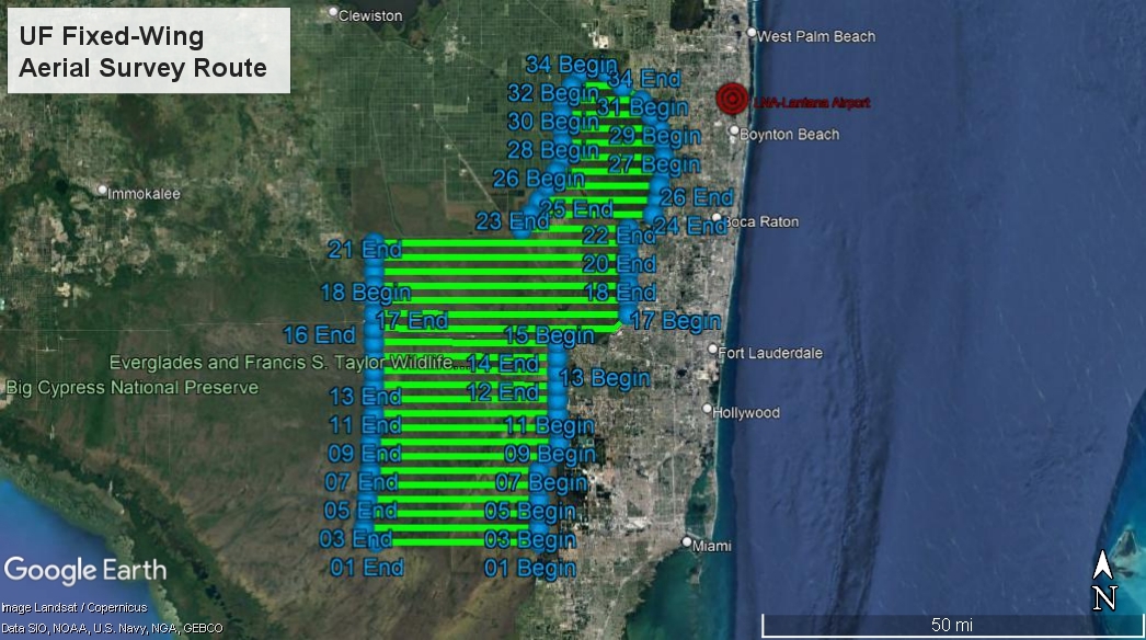
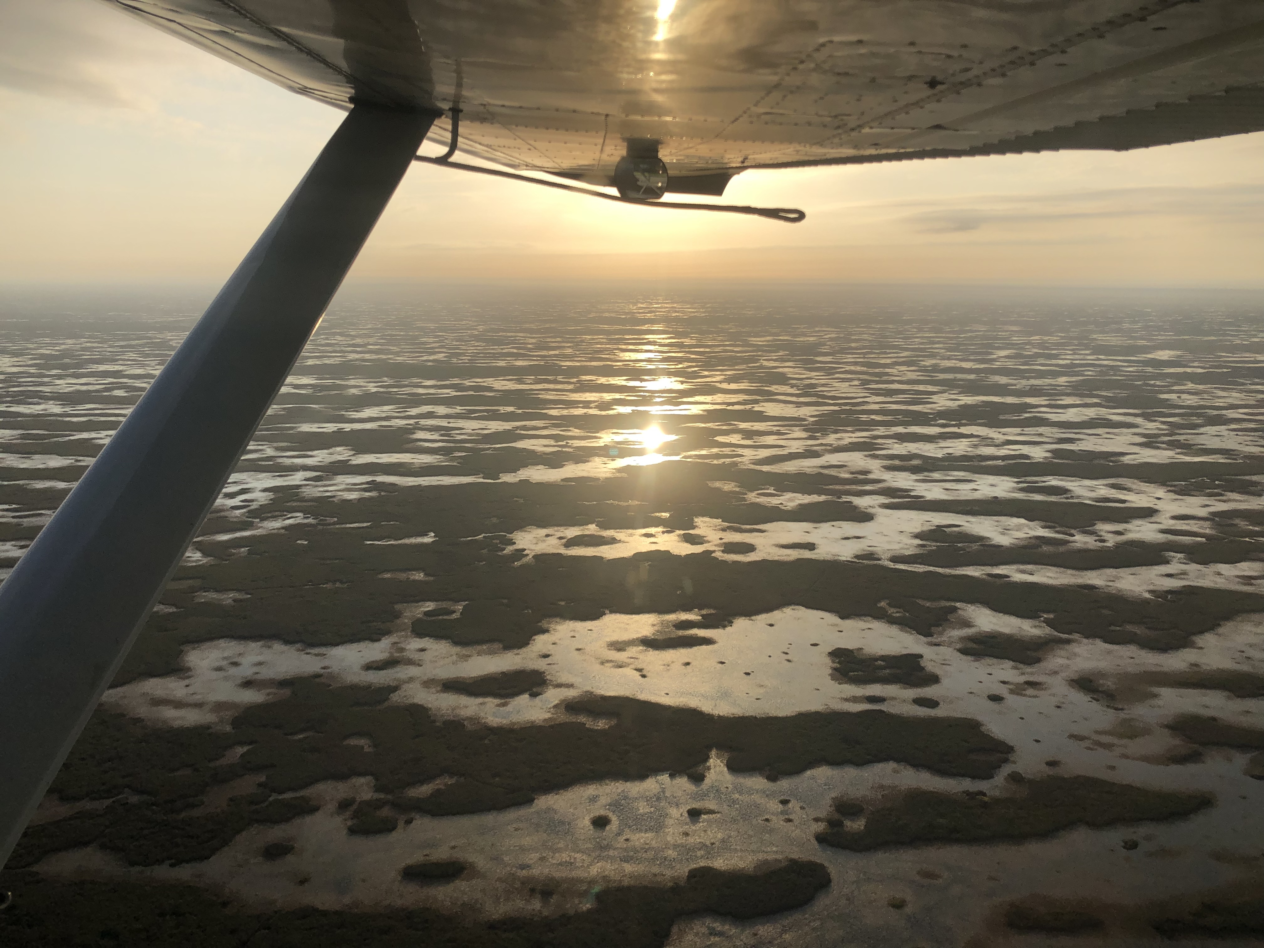
To determine the distribution and total number of Wading Bird nesting pairs throughout the Water Conservation Areas, we conduct systematic monthly aerial surveys over the entire study area from mid-January through mid-June. These are done at an altitude of 800’ from a Cessna 185 flown by a contracted pilot with appropriate qualifications and experience. Front- and rear-seat observers search for nest colonies and, when one is located, make visual count estimates of all light-plumaged species of wading birds. Colony locations are determined using hand-held GPS receivers. Using a digital camera, photographs of each colony are also taken for later analysis. The full survey usually takes three to four morning flights each month to complete.
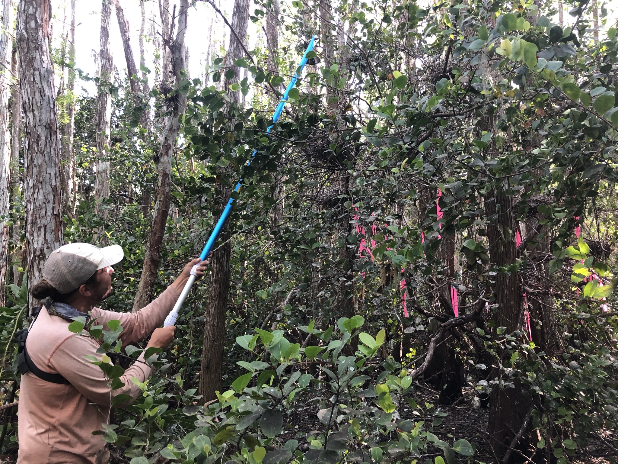
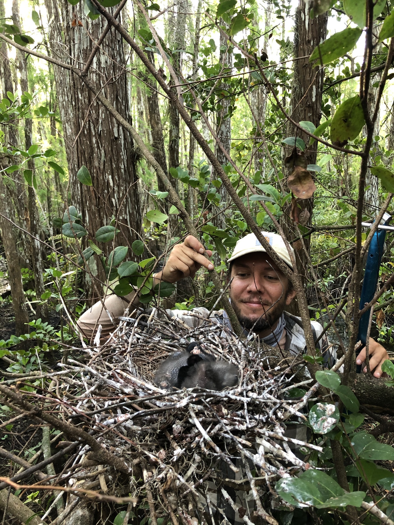
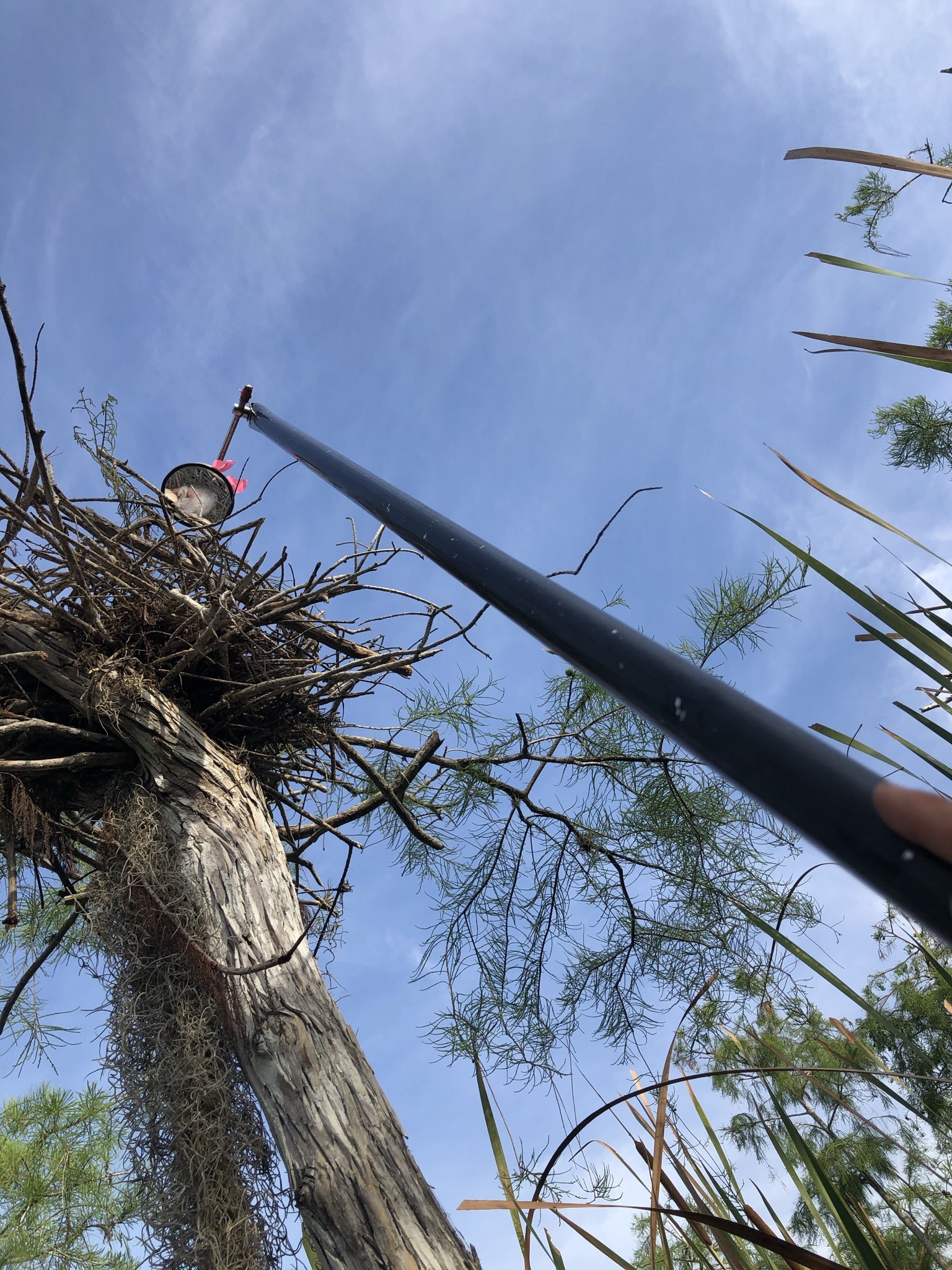
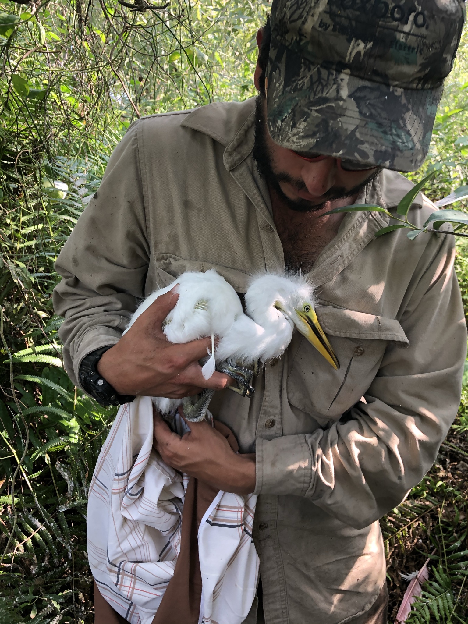
Throughout the nesting period we regularly access 5-8 larger colonies to gather nest stage and nest success data. We travel to these colonies via airboat and enter the colonies on foot. We mark individual nests of wading birds and count numbers of eggs and chicks weekly until the chicks fledge or the nest fails. These checks are done in the cooler morning or evening periods of the day and for no more than 60 consecutive minutes to minimize our impact on the colony. Telescoping mirror poles are used to peer into higher nests among the canopy. While colonies are located on tree “islands” these islands are usually inundated with water and require field technicians to wade through water, mud, and sometimes thick vegetation.
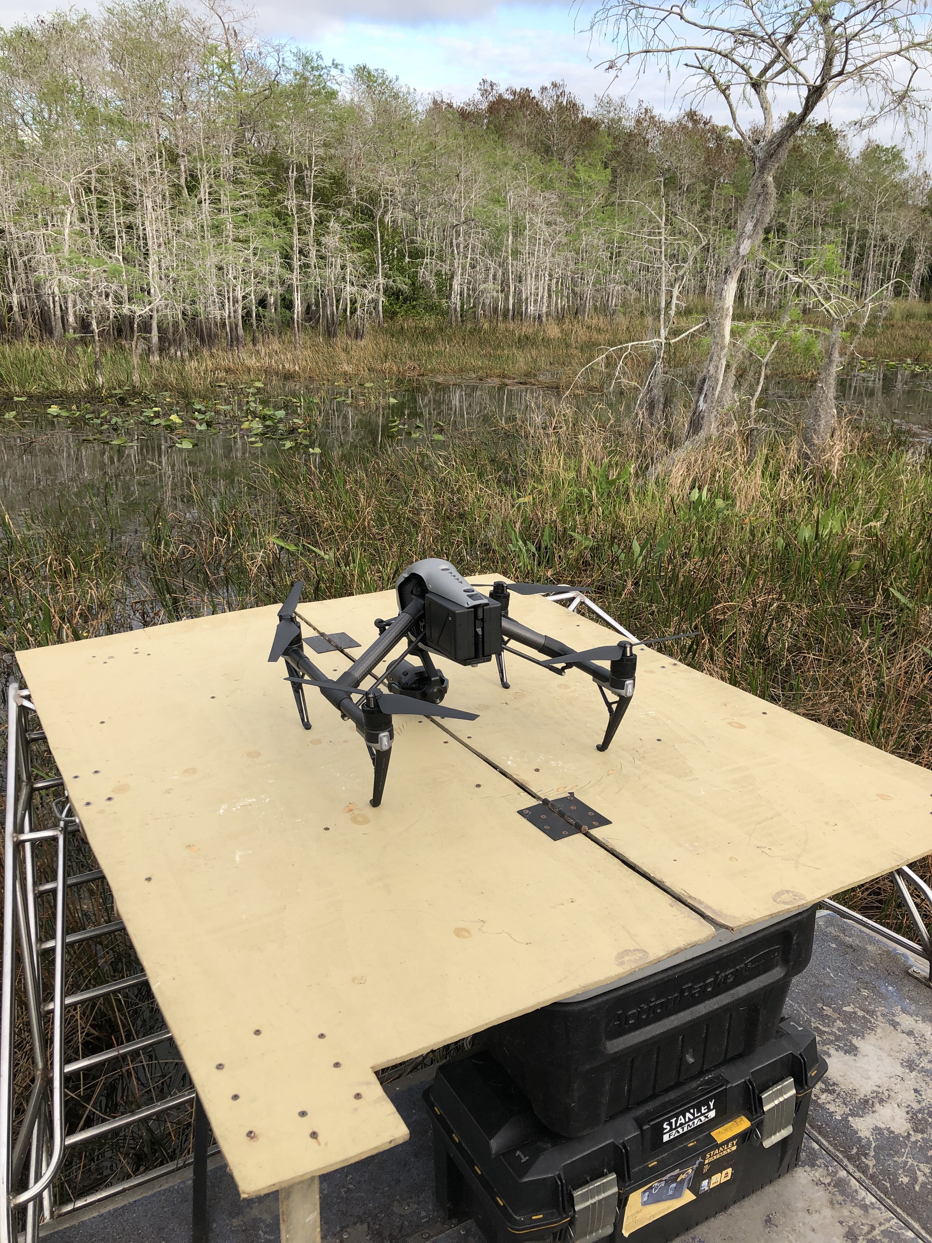
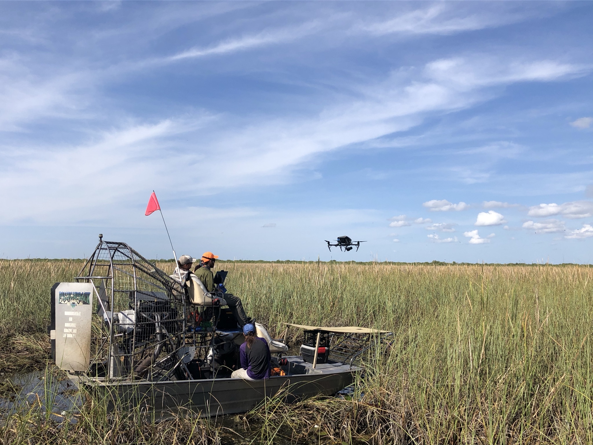
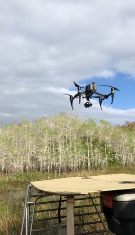
To coincide with weekly nest checks, we also survey these colonies via weekly UAV or “drone” flights. These surveys provide high quality imagery of the entire colony on a weekly scale. We can use this data to determine nest turnover, nest success, and species ID via machine learning. These technologies can provide us with more data through larger sample sizes and additional information on the overall characteristics of the colony, with potentially less disturbance.
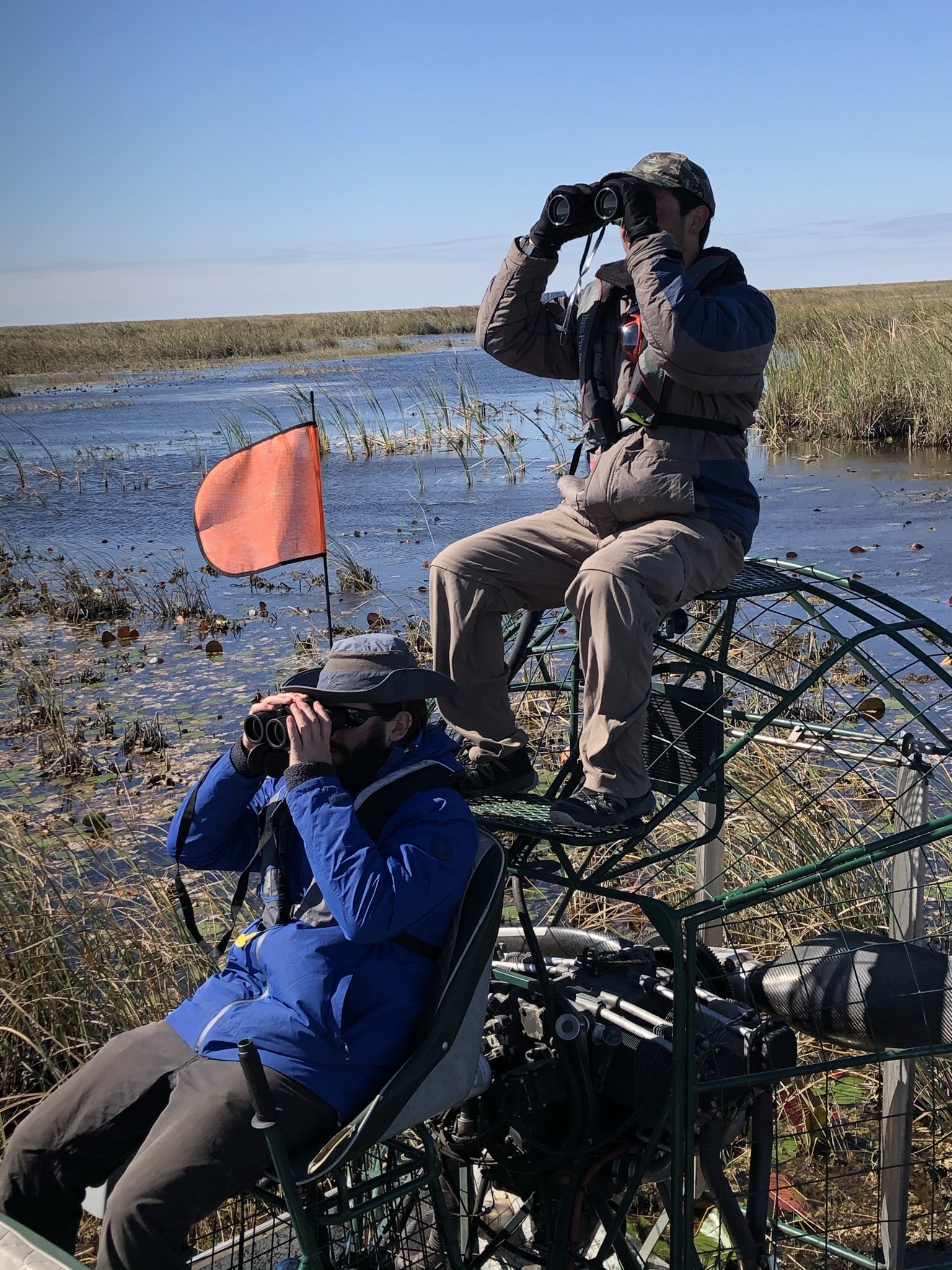
At the height of the nesting season we spend two weeks completing systematic ground surveys in WCA 3a (using airboats). These surveys consist of long days of driving airboats along standardized routes. Species of wading birds flushed from each tree island along the routes are identified and counted. These surveys provide a much better estimate of dark-plumaged and non-colonial nesters that cannot be obtained from the air due to low detection rates.